 Catalogue PIGMA
Channel-North Sea
Type of resources
Available actions
Topics
Keywords
Contact for the resource
Provided by
Representation types
Update frequencies
status
Scale
-
-
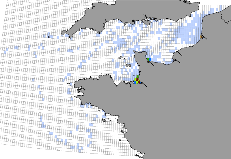
Location distribution per grid cell of 8 young harbor seals (Phoca vitulina), followed by Argos tags (between 2005 and 2008) along the English Channel coast following rehabilitation at the care center CHENE.
-
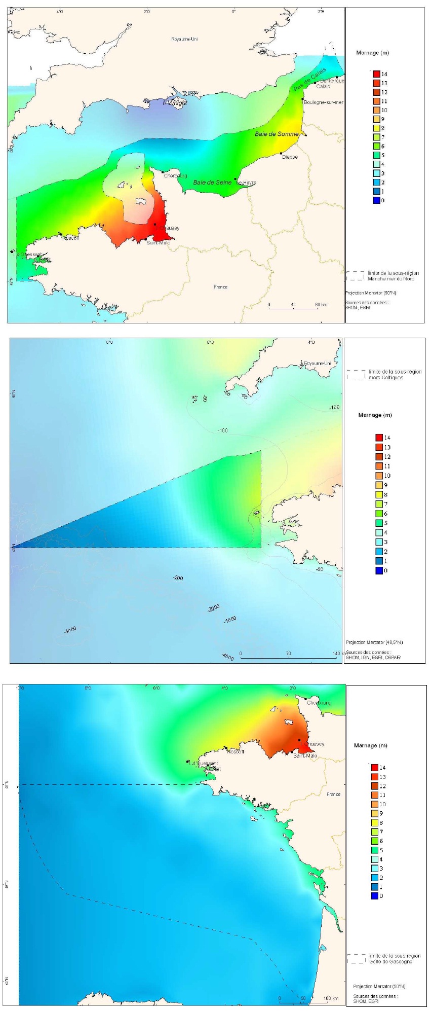
Zones corresponding to the delimitation of major watersheds and related marine areas in the Seine-Normandy basin for the assessment of pressures on the different water masses on the Normandy coast and marine sub region English Channel - North Sea. Nutrient discharges from industries and communities.
-
-
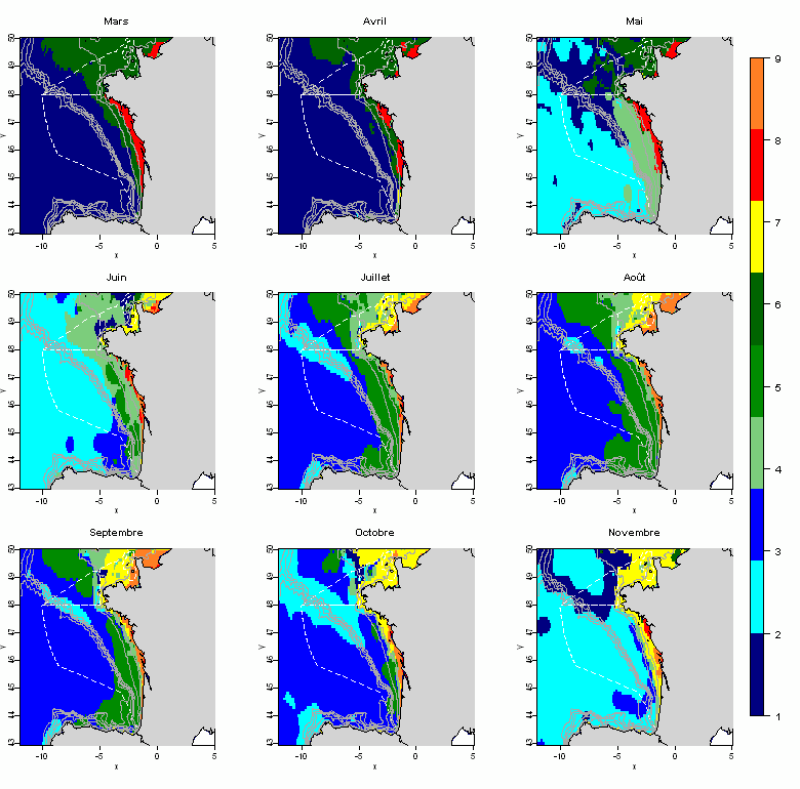
The statistical analysis used (Principal Component Analysis followed by a classification method) to identify groups common to all months and describe the evolution of these groups during the year. The data used allows for monthly tables showing the selected parameters, calculated over the entire geographic area with a resolution of 0.1 °. This method identifies 10 hydrological landscapes present at various times of the year, and characterized by homogeneous hydrological conditions.
-
-
-
-
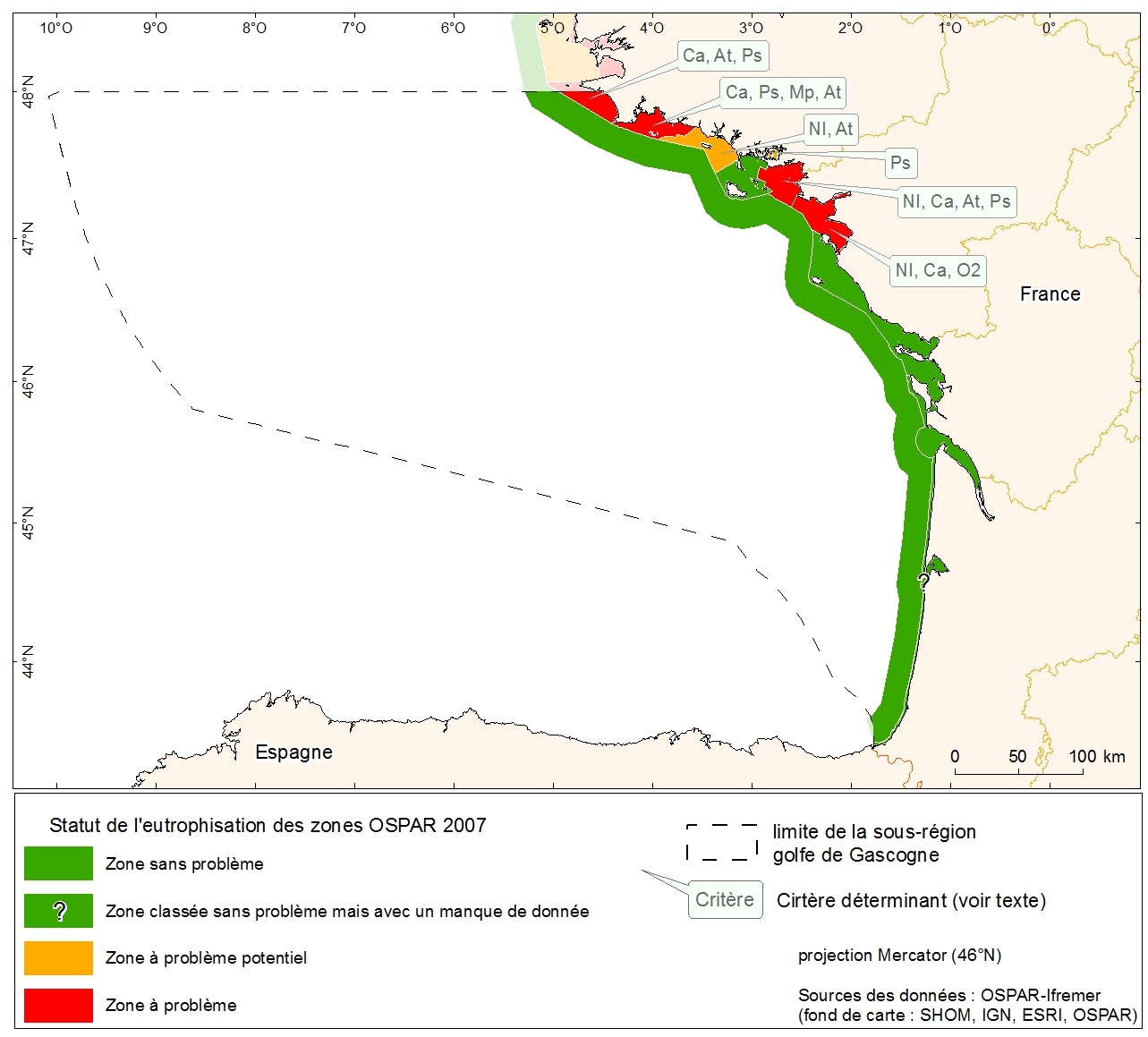
Eutrophication status of the OSPAR of 2007 zones of metropolitan France. Data collected in the course of "initial assessment" phase of the MSFD.
-
Counting beached marine turtles on the Channel- Atlantic coast, identifying the causes of mortality in dead beached individuals, rehabilitating and releasing live beached individuals into the wild.